Typhoon Hinnamnor Weakens but Remains a Threat to Ryukyus

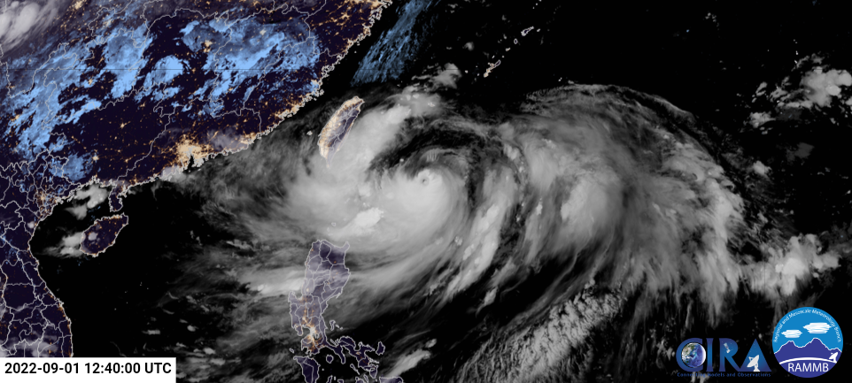
Typhoon Hinnamnor has weakened once again but it remains a powerful typhoon as it continues to approach the Ryukyu Islands.
Current Information
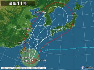
As of 6pm Japan Standard Time, Hinnamnor is currently located at 21.5 degrees north, 125.5 degrees east, about 370 kilometers (230 nautical miles) to the south of Miyakojima. It currently has 10-minute winds of 195 kph (120 mph), with gusts up to 280 kph (175 mph), and a minimum central pressure of 920 hPa, according to the Japan Meteorological Agency. The Joint Typhoon Warning Center estimated Hinnamnor to have 1-minute sustained winds of 250 kph (155 mph) and a minimum central pressure of 921 hPa. It is currently moving south at 13 kph (8 mph).
Current Warnings
Currently, there is a Gale Advisory for Ishigaki, Yonaguni, and the Daito Islands, a Signal #1 warning for Batanes and the Babuyan Islands in the Philippines, and a Strong Wind Advisory for the entirety of Taiwan. Moreover, the island of Ishigaki is under a High Wave Advisory, heavy rain and flood advisories. The island of Okinawa is under a Storm Surge Advisory.
For up to date storm information, please check products issued by your local meteorological agency.
Current forecast

According to the JMA, Hinnamnor is expected to intensify slightly before weakening as it remains almost stationary due to weak steering flow until Saturday, where it’ll move north along the periphery of a mid-level subtropical high, and reintensify once again to a peak forecast intensity of 185 kph (115 mph). The typhoon will then move northeastwards as it gets influenced by the mid-latitude westerlies while weakening again.
Expected Threats
As Hinnamnor becomes nearly stationary, the Batanes Islands will continue to get hit with moderate to heavy rainfall, with the Babuyan Islands expected to be affected with the same hazard tomorrow. Under those conditions, isolated to scattered flooding (including flash floods) and rain-induced landslides are possible especially in areas that are highly or very highly susceptible to these hazard as identified in hazard maps, and in localities with significant antecedent rainfall. It is expected to continue till Saturday. The storm is also forecast to enhance the Southwest Monsoon and may bring rainfall to the western section of Luzon starting tomorrow.
As the typhoon moves north on Saturday, the Sakishima Islands are expected to observe maximum winds of 144-180 kph, and 10-meter-high waves generated by Hinnamnor. People are urged to remain on the alert for gale-force winds and high waves, and to stay updated on evacuation notices and other information about the typhoon.
Stay tuned to your local meteorological office and to us here at Force Thirteen, and stay safe from this storm if you are in the path. We will continue to give updates on the storm as it progresses.
