Tropical Storm Hanna was located near 33.7°N, 43.9°W, or about 811 miles (1306 km) west-southwest of Santa Cruz das Flores, Azores. Hanna has maximum sustained winds of 35 knots and a minimum central pressure of 1005 millibars.
Hurricane Nolo was located near 21.8°N, 164.2°W, or about 409 miles (658 km) west of Honolulu, Hawaii. Nolo has maximum sustained winds of 80 knots and a minimum central pressure of 974 millibars.
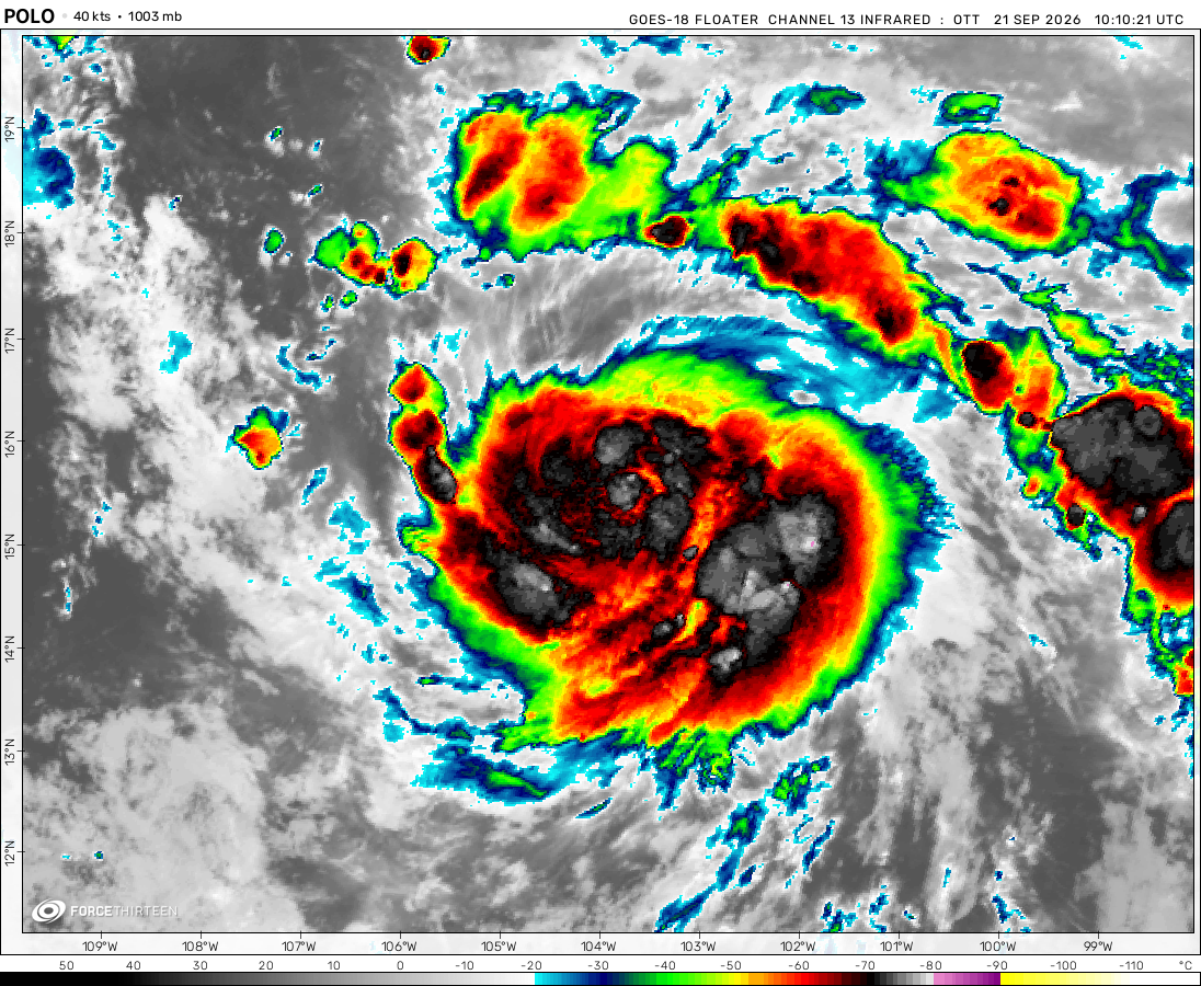
The remnants of Polo was located near 30.0°N, 108.5°W, or about 484 miles (779 km) north-northwest of Mazatlán, Mexico. Polo has maximum sustained winds of 30 knots and a minimum central pressure of 996 millibars.
Tropical Storm Rachel was located near 16.6°N, 106.3°W, or about 216 miles (348 km) southwest of Manzanillo, Mexico. Rachel has maximum sustained winds of 60 knots and a minimum central pressure of 989 millibars.
Tropical Depression Nineteen-e was located near 13.9°N, 130.6°W, or about 1097 miles (1766 km) west-southwest of Clarion Island, Mexico. Nineteen-e has maximum sustained winds of 25 knots and a minimum central pressure of 1006 millibars.
ATCF®
- Latest Information -
As of September 30th 2026 at 05:31 UTC
Tropical Storm Surigae was located near 30.2°N, 137.3°E, or about 344 miles (554 km) south-southeast of Kyoto, Japan. Surigae has maximum sustained winds of 35 knots and a minimum central pressure of 1000 millibars.
Tropical Depression 26W was located near 15.6°N, 151.9°E, or about 500 miles (805 km) east-northeast of Hagåtña, Guam. 26W has maximum sustained winds of 25 knots and a minimum central pressure of 1005 millibars.
ATCF®
- Latest Information -
As of September 30th 2026 at 05:31 UTC
The remnants of Fay was located near 23.9°N, 47.7°W, or about 1041 miles (1676 km) east-northeast of Pointe-à-Pitre, Guadeloupe. Fay has maximum sustained winds of 25 knots and a minimum central pressure of 1011 millibars.
sometimes u have 2 reload the page; it shows nothing at first
Hurricane Grace
4 years ago
Blas’s intensification really surprised me. I expected it to be no more than a severe tropical storm, but now the National Hurricane Center says that it’s a rapid intensifying storm and will become a C2 tomorrow
yjx
4 years ago
so how often does nhc update anyway
Force 31
4 years ago
i suspect that they update comments once a month
heqt
4 years ago
Blas is now a storm.Maybe it will become a Cat 2?
Okeechobee's Bane
4 years ago
F13 says that invest 94s is moving -9999.99 degrees at -10000 mph, lol
Hurricane iou
4 years ago
ohyeah 92E finally TD 2-E
Okeechobee's Bane
4 years ago
92E has a very high chance of forming
Hurricane Grace
4 years ago
92E is a depression now but F13 still says its name is invest
Hurricane Grace
4 years ago
93S has been here for almost a week now and had not intensified into a tropical storm or dissipated
Cookies help us ensure our site works securely, continually make improvements, and personalize your browsing experience.
Click 'Accept All Cookies' to get the best browsing experience. You can change these settings at any time by clicking 'Manage My Cookies' below.
Functional
Always active
The technical storage or access is strictly necessary for the legitimate purpose of enabling the use of a specific service explicitly requested by the subscriber or user, or for the sole purpose of carrying out the transmission of a communication over an electronic communications network.
Preferences
The technical storage or access is necessary for the legitimate purpose of storing preferences that are not requested by the subscriber or user.
Statistics
The technical storage or access that is used exclusively for statistical purposes.The technical storage or access that is used exclusively for anonymous statistical purposes. Without a subpoena, voluntary compliance on the part of your Internet Service Provider, or additional records from a third party, information stored or retrieved for this purpose alone cannot usually be used to identify you.
Marketing
The technical storage or access is required to create user profiles to send advertising, or to track the user on a website or across several websites for similar marketing purposes.

 View more imageryAnimated GIF
 View more imageryAnimated GIF
 View more imageryAnimated GIF
 View more imageryAnimated GIF
 View more imageryAnimated GIF
 View more imageryAnimated GIF
there are 7 active systems and PTC Two‘s looking very promising, wow
Invest 94L has a 40% chance to form
why is their no Celia
sometimes u have 2 reload the page; it shows nothing at first
Blas’s intensification really surprised me. I expected it to be no more than a severe tropical storm, but now the National Hurricane Center says that it’s a rapid intensifying storm and will become a C2 tomorrow
so how often does nhc update anyway
i suspect that they update comments once a month
Blas is now a storm.Maybe it will become a Cat 2?
F13 says that invest 94s is moving -9999.99 degrees at -10000 mph, lol
ohyeah 92E finally TD 2-E
92E has a very high chance of forming
92E is a depression now but F13 still says its name is invest
93S has been here for almost a week now and had not intensified into a tropical storm or dissipated
alex still had not intensified into a Cat1(“▔□▔)
why hasnt alex intensified into a Cat1
The NHC does not recognize it anymore
The NHC doesn’t recognize extratropical cyclones. Which is unfortunate.
Why does 91L show undefined, is this thing not working or is it crash?
Why does 91L show undefined, is it broken?
invest 90L most likely won’t develop
We have a cyclone over South Africa now
typhoon this early dag
There was 2 before
why its not working
._.