Tropical Storm Hanna was located near 33.7°N, 44.2°W, or about 826 miles (1329 km) west-southwest of Santa Cruz das Flores, Azores. Hanna has maximum sustained winds of 35 knots and a minimum central pressure of 1006 millibars.
Hurricane Nolo was located near 22.4°N, 164.2°W, or about 414 miles (666 km) west-northwest of Honolulu, Hawaii. Nolo has maximum sustained winds of 65 knots and a minimum central pressure of 984 millibars.
Hurricane Rachel was located near 17.3°N, 106.9°W, or about 210 miles (337 km) southwest of Manzanillo, Mexico. Rachel has maximum sustained winds of 70 knots and a minimum central pressure of 979 millibars.
Tropical Depression Nineteen-e was located near 13.8°N, 129.8°W, or about 1049 miles (1688 km) west-southwest of Clarion Island, Mexico. Nineteen-e has maximum sustained winds of 25 knots and a minimum central pressure of 1006 millibars.
ATCF®
- Latest Information -
As of September 30th 2026 at 07:01 UTC
Tropical Storm Surigae was located near 31.2°N, 138.3°E, or about 301 miles (485 km) south-southeast of Kyoto, Japan. Surigae has maximum sustained winds of 35 knots and a minimum central pressure of 1000 millibars.
Tropical Depression 26W was located near 15.8°N, 150.9°E, or about 441 miles (710 km) east-northeast of Hagåtña, Guam. 26W has maximum sustained winds of 30 knots and a minimum central pressure of 1001 millibars.
ATCF®
- Latest Information -
As of September 30th 2026 at 07:01 UTC
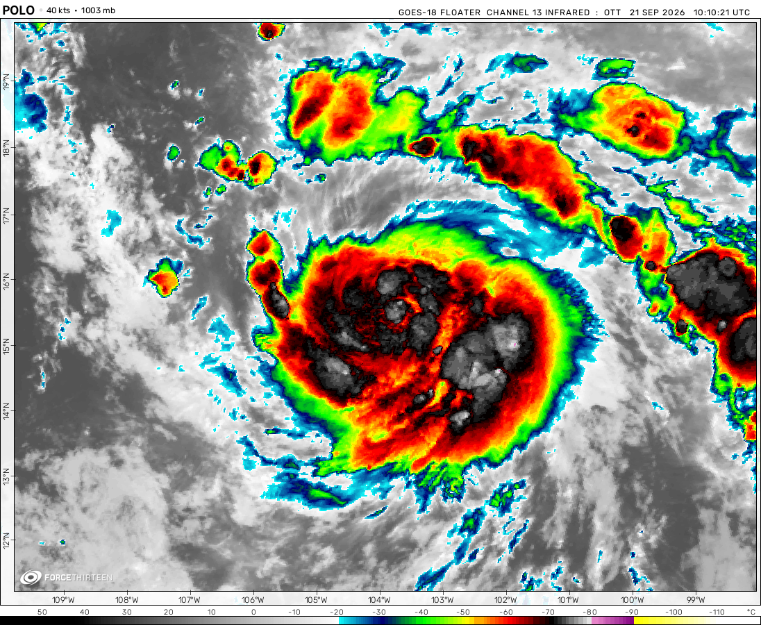
Tropical Depression Polo was located near 30.0°N, 108.5°W, or about 484 miles (779 km) north-northwest of Mazatlán, Mexico. Polo has maximum sustained winds of 30 knots and a minimum central pressure of 996 millibars.
Tropical Depression Fay was located near 23.9°N, 47.7°W, or about 1041 miles (1676 km) east-northeast of Pointe-à-Pitre, Guadeloupe. Fay has maximum sustained winds of 25 knots and a minimum central pressure of 1011 millibars.
roslyn is now the 4th MH in epac ! but i remember that in may the nhc originally predicted only 3 MHs for EPAC .
Hurricane Grace
3 years ago
maybe roslyn will become a mh
Hurricane Ian
3 years ago
Lisa formed!?! Also Roslyn is as 69mph, nice 👍
Polar Storms
3 years ago
Roslyn has formed!
Nathan
3 years ago
69 mph Nesat. Also why did they name some convention haitang?
what is a hurricane?
3 years ago
Cat 3 Nesat! That’s going to (an already) Cause a lot of damage
what is a hurricane?
3 years ago
Cat 3 Nesat! That is going to be a bad landfall.
Polar Storms
3 years ago
Nests looking good on satellite
Force 31
3 years ago
personally i think nesat may become a cat 3/4. just look at its compact cloud tops!
???
3 years ago
Sonca, Nesat, 21W and invest 93W I think, are make the tallies for the west pac go waaaaaaay up.
Polar Storms
3 years ago
Sonca and Nesat have formed with many other areas that could form. Also why is subtropical depression invest marked over nesat? Also the wind speeds and pressures are different. Just a bug?
Cookies help us ensure our site works securely, continually make improvements, and personalize your browsing experience.
Click 'Accept All Cookies' to get the best browsing experience. You can change these settings at any time by clicking 'Manage My Cookies' below.
Functional
Always active
The technical storage or access is strictly necessary for the legitimate purpose of enabling the use of a specific service explicitly requested by the subscriber or user, or for the sole purpose of carrying out the transmission of a communication over an electronic communications network.
Preferences
The technical storage or access is necessary for the legitimate purpose of storing preferences that are not requested by the subscriber or user.
Statistics
The technical storage or access that is used exclusively for statistical purposes.The technical storage or access that is used exclusively for anonymous statistical purposes. Without a subpoena, voluntary compliance on the part of your Internet Service Provider, or additional records from a third party, information stored or retrieved for this purpose alone cannot usually be used to identify you.
Marketing
The technical storage or access is required to create user profiles to send advertising, or to track the user on a website or across several websites for similar marketing purposes.

 View more imageryAnimated GIF
 View more imageryAnimated GIF
 View more imageryAnimated GIF
 View more imageryAnimated GIF
 View more imageryAnimated GIF
 View more imageryAnimated GIF
T.S Nalgae formed. This could be a classic late season super typhoon. Prayers going to Luzon
nalgae may get retired The floods in Luzon were pretty devastating.
why is there no system
finally we got sitrang!
Sitrang is in Tibet!?!
Roslyn making a run for the Gulf of Mexico!
Sittrang soon maybe 00Z we will get it
roslyn is now the 4th MH in epac ! but i remember that in may the nhc originally predicted only 3 MHs for EPAC .
maybe roslyn will become a mh
Lisa formed!?! Also Roslyn is as 69mph, nice 👍
Roslyn has formed!
69 mph Nesat. Also why did they name some convention haitang?
Cat 3 Nesat! That’s going to (an already) Cause a lot of damage
Cat 3 Nesat! That is going to be a bad landfall.
Nests looking good on satellite
personally i think nesat may become a cat 3/4. just look at its compact cloud tops!
Sonca, Nesat, 21W and invest 93W I think, are make the tallies for the west pac go waaaaaaay up.
Sonca and Nesat have formed with many other areas that could form. Also why is subtropical depression invest marked over nesat? Also the wind speeds and pressures are different. Just a bug?
that is another system, invest 91W.
why isnt 21W named
97W is starting to wrap itself together. GFS says it will make landfall around cat 1 in Taiwan.
there is many invests right now, 5 of them but I don’t think they will all form