Typhoon Surigae was located near 24.6°N, 127.6°E, or about 112 miles (179 km) south of Naha, Okinawa. Surigae has maximum sustained winds of 85 knots and a minimum central pressure of 968 millibars.
Tropical Depression Fay was located near 29.9°N, 43.9°W, or about 979 miles (1576 km) southwest of Santa Cruz das Flores, Azores. Fay has maximum sustained winds of 30 knots and a minimum central pressure of 1009 millibars.
Tropical Storm Gonzalo was located near 19.0°N, 23.2°W, or about 188 miles (302 km) northeast of Mindelo, Cabo Verde. Gonzalo has maximum sustained winds of 35 knots and a minimum central pressure of 1005 millibars.
Hurricane Nolo was located near 16.8°N, 155.7°W, or about 206 miles (331 km) south-southwest of Hilo, Hawaii. Nolo has maximum sustained winds of 85 knots and a minimum central pressure of 977 millibars.
Hurricane Odalys was located near 20.2°N, 123.6°W, or about 593 miles (954 km) west-northwest of Clarion Island, Mexico. Odalys has maximum sustained winds of 80 knots and a minimum central pressure of 973 millibars.
Hurricane Polo was located near 18.3°N, 112.2°W, or about 87 miles (140 km) west-southwest of Socorro Island, Mexico. Polo has maximum sustained winds of 125 knots and a minimum central pressure of 938 millibars.
Invest 90E was located near 11.6°N, 99.0°W, or about 322 miles (518 km) south-southwest of Puerto Escondido, Mexico. 90E has maximum sustained winds of 25 knots and a minimum central pressure of 1008 millibars.
Invest 92W was located near 15.2°N, 98.8°E, or about 151 miles (244 km) northwest of Bangkok, Thailand. 92W has maximum sustained winds of 20 knots and a minimum central pressure of 1005 millibars.
The remnants of 01B was located near 26.0°N, 82.6°E, or about 377 miles (607 km) east-southeast of New Delhi, India. 01B has maximum sustained winds of 15 knots and a minimum central pressure of 999 millibars.
i do believe that basins in both hemispheres can support at least a tropical cyclone, the water there is still decent. it’s just lacking a spark to ignite the whole thing… anyone agrees with me? it’s like.. the soil is fertile but there’s no seeds, saplings,…
we will be having another haiyan if there’s more time for jelawat to intensify, luckily it’s boutta make landfall soon and such things like that won’ t happen
JTWC is conducting a scheduled power outage and has transferred services to FWC-N and FWC-SD, estimated restoral 17 DECEMBER 2023, 2200 UTC
ATCF products, including the one used by this site (through https://www.knackwx.com), will not work properly. I am reporting this in advance for potential outdated data as there are no longer any other available data streams. I will do my best to provide updated data during this outage.
Moving forward, prototype plans have been drafted for these types of issues not covered.
jasper will feed off the juicy sweet boiling waters in the gulf, which is worrisome. also, it’s looking good despite traversing over land (idk why, any explanations?)
Wind shear is defined as a change of windspeed (and direction) in different atmospheric layers.
You want a uniform stream of air coming from one place (called steering wind flow) across the entire atmosphere that can push a storm in one direction. In this case from the southeast (Southern Hemisphere) or northeast (Northern Hemisphere) to push it towards the equator.
Force13Fanatic
2 years ago
91W will do the Fujiwara effect with Cyclone Jasper.
Cookies help us ensure our site works securely, continually make improvements, and personalize your browsing experience.
Click 'Accept All Cookies' to get the best browsing experience. You can change these settings at any time by clicking 'Manage My Cookies' below.
Functional
Always active
The technical storage or access is strictly necessary for the legitimate purpose of enabling the use of a specific service explicitly requested by the subscriber or user, or for the sole purpose of carrying out the transmission of a communication over an electronic communications network.
Preferences
The technical storage or access is necessary for the legitimate purpose of storing preferences that are not requested by the subscriber or user.
Statistics
The technical storage or access that is used exclusively for statistical purposes.The technical storage or access that is used exclusively for anonymous statistical purposes. Without a subpoena, voluntary compliance on the part of your Internet Service Provider, or additional records from a third party, information stored or retrieved for this purpose alone cannot usually be used to identify you.
Marketing
The technical storage or access is required to create user profiles to send advertising, or to track the user on a website or across several websites for similar marketing purposes.

 View more imageryAnimated GIF
 View more imageryAnimated GIF
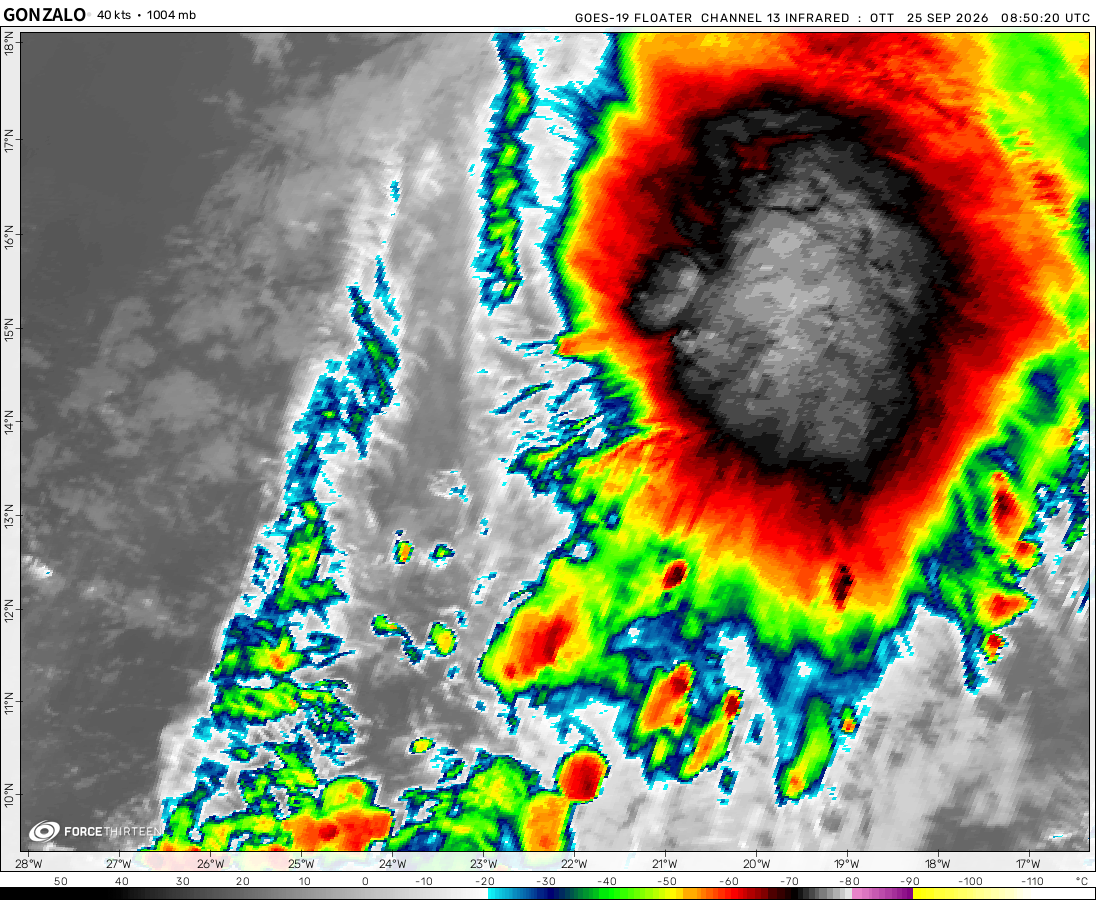 View more imageryAnimated GIF
 View more imageryAnimated GIF
 View more imageryAnimated GIF
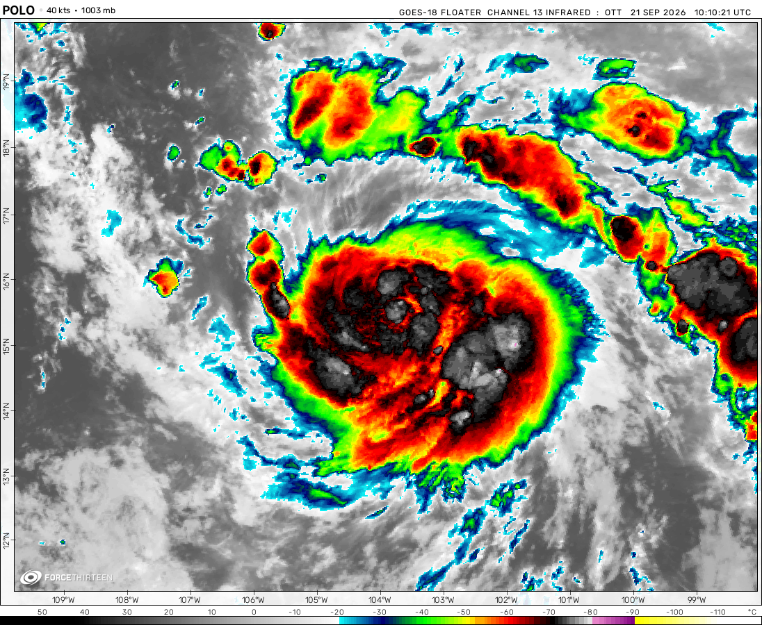 View more imageryAnimated GIF
 View more imagery
 View more imageryAnimated GIF
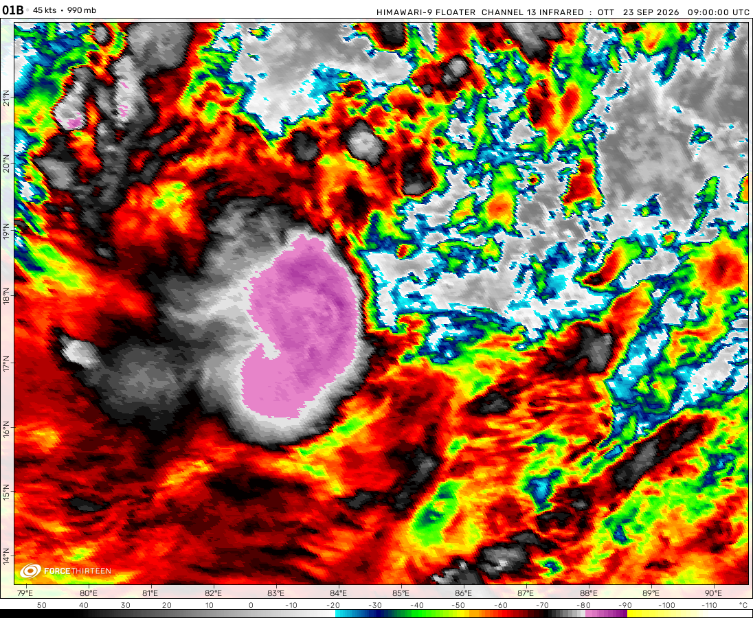 View more imageryAnimated GIF
Did 91W become Jelawat?
dead
Guys: How many storm names do you think will be retired this year?
Idalia, Otis
The names Idalia, Lidia, and Otis will be retired. I do not know about Lidia, but the other two will be retired.
Dora probably.
Why?
i do believe that basins in both hemispheres can support at least a tropical cyclone, the water there is still decent. it’s just lacking a spark to ignite the whole thing… anyone agrees with me? it’s like.. the soil is fertile but there’s no seeds, saplings,…
This partly explains why WPAC is so quiet this winter.
yeah I see
we will be having another haiyan if there’s more time for jelawat to intensify, luckily it’s boutta make landfall soon and such things like that won’ t happen
JMA Has named 91W into Jelawat and is now a TS.
ATCF products, including the one used by this site (through https://www.knackwx.com), will not work properly. I am reporting this in advance for potential outdated data as there are no longer any other available data streams. I will do my best to provide updated data during this outage.
Moving forward, prototype plans have been drafted for these types of issues not covered.
How’d u get the big text?
JMA TD Track https://www.jma.go.jp/bosai/map.html#6/8.994/130.078/&elem=root&typhoon=all&contents=typhoon&lang=en
91W is apparently a TD to JMA
jasper is now just a mess of thunderstorms
https://www.tropicaltidbits.com/analysis/models/?model=gfs®ion=aus&pkg=mslp_pcpn_frzn&runtime=2023121406&fh=6
jasper will feed off the juicy sweet boiling waters in the gulf, which is worrisome. also, it’s looking good despite traversing over land (idk why, any explanations?)
https://www.tropicaltidbits.com/analysis/models/?model=gfs®ion=aus&pkg=mslp_pcpn_frzn&runtime=2023121306&fh=6
it can’t be…
Remember that GFS originally expected Ilsa to peak as a 882-mb cyclone.
GFS is rlly trusty, but we must be aware that they aren’t 100% correct, especially in the longer range
WHAT
look at this: GFS Model – MSLP & Precip (Rain/Frozen) for Australia | Tropical Tidbits check out frame +312! it peaks at 917 hpa but it is very uncertain yet to make any decisions
I think this cyclone will get a 2nd life and probably be stronger.
can wind shear pushes tropical cyclones equator-ward? if the cyclone does reach the equator, what will happen?
yes maybe, but the storm will quickly weaken and dissipate
Wind shear is defined as a change of windspeed (and direction) in different atmospheric layers.
You want a uniform stream of air coming from one place (called steering wind flow) across the entire atmosphere that can push a storm in one direction. In this case from the southeast (Southern Hemisphere) or northeast (Northern Hemisphere) to push it towards the equator.
91W will do the Fujiwara effect with Cyclone Jasper.
no
It seems that 91W is on a consolidating trend.
https://www.tropicaltidbits.com/analysis/models/?model=gfs®ion=aus&pkg=mslp_pcpn_frzn&runtime=2023121106&fh=6
jasper will be fueling further destruction (by creating more instability), or will it be having it’s second life? only the time will tell us….
92P isn’t likely to develop
https://www.tropicaltidbits.com/analysis/models/?model=gfs®ion=aus&pkg=mslp_pcpn_frzn&runtime=2023121006&fh=6
be sure to check it out, that model run will be something to watch out, which is worrrisome