Tropical Depression Fay was located near 26.9°N, 44.9°W, or about 1175 miles (1890 km) southwest of Santa Cruz das Flores, Azores. Fay has maximum sustained winds of 30 knots and a minimum central pressure of 1011 millibars.
Tropical Storm Hanna was located near 36.6°N, 49.6°W, or about 774 miles (1245 km) south-southeast of St. John's, Newfoundland. Hanna has maximum sustained winds of 40 knots and a minimum central pressure of 1006 millibars.
ATCF®
- Latest Information -
As of September 28th 2026 at 20:31 UTC
Hurricane Nolo was located near 17.3°N, 162.7°W, or about 420 miles (676 km) southwest of Honolulu, Hawaii. Nolo has maximum sustained winds of 130 knots and a minimum central pressure of 933 millibars.
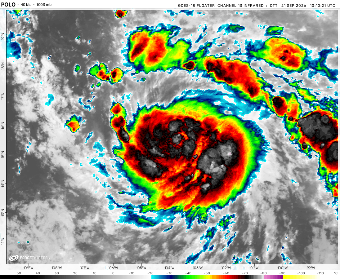
Hurricane Polo was located near 24.6°N, 113.4°W, or about 250 miles (402 km) west-northwest of Cabo San Lucas, Mexico. Polo has maximum sustained winds of 100 knots and a minimum central pressure of 963 millibars.
Tropical Storm Rachel was located near 13.9°N, 101.5°W, or about 233 miles (374 km) south-southwest of Acapulco, Mexico. Rachel has maximum sustained winds of 45 knots and a minimum central pressure of 999 millibars.
Typhoon Surigae was located near 28.1°N, 133.2°E, or about 196 miles (316 km) northeast of Minami-Daitō Island, Japan. Surigae has maximum sustained winds of 70 knots and a minimum central pressure of 976 millibars.
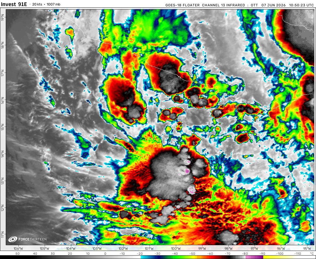
Invest 91E was located near 13.8°N, 134.9°W, or about 1375 miles (2213 km) west of Clarion Island, Mexico. 91E has maximum sustained winds of 30 knots and a minimum central pressure of 1005 millibars.
Invest 92W was located near 18.8°N, 97.4°E, or about 394 miles (634 km) east-southeast of Cox's Bazar, Bangladesh. 92W has maximum sustained winds of 20 knots and a minimum central pressure of 1006 millibars.
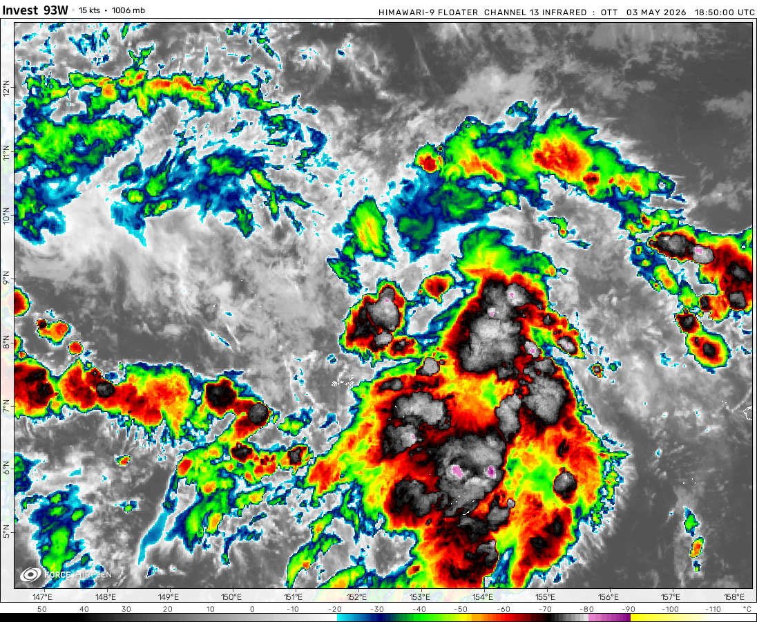
Invest 93W was located near 15.2°N, 155.5°E, or about 687 miles (1105 km) north of Chuuk, Micronesia. 93W has maximum sustained winds of 20 knots and a minimum central pressure of 1007 millibars.
Cookies help us ensure our site works securely, continually make improvements, and personalize your browsing experience.
Click 'Accept All Cookies' to get the best browsing experience. You can change these settings at any time by clicking 'Manage My Cookies' below.
Functional
Always active
The technical storage or access is strictly necessary for the legitimate purpose of enabling the use of a specific service explicitly requested by the subscriber or user, or for the sole purpose of carrying out the transmission of a communication over an electronic communications network.
Preferences
The technical storage or access is necessary for the legitimate purpose of storing preferences that are not requested by the subscriber or user.
Statistics
The technical storage or access that is used exclusively for statistical purposes.The technical storage or access that is used exclusively for anonymous statistical purposes. Without a subpoena, voluntary compliance on the part of your Internet Service Provider, or additional records from a third party, information stored or retrieved for this purpose alone cannot usually be used to identify you.
Marketing
The technical storage or access is required to create user profiles to send advertising, or to track the user on a website or across several websites for similar marketing purposes.

 View more imageryAnimated GIF
 View more imageryAnimated GIF
 View more imageryAnimated GIF
 View more imageryAnimated GIF
 View more imageryAnimated GIF
 View more imageryAnimated GIF
 View more imageryAnimated GIF
 View more imageryAnimated GIF
r/gradeporn
Jamaica’s screwed.
Uh oh here comes an M curse
Just playing MK Tour as ργτhοη_mkw
THis is not even funny, they did this on purpose, no, I did not use inspect.
If this somehow forms up, it’ll be the northernmost forming tropical/subtropical storm on record.
It probably has formed unofficially
it formed.
Welp..
guys, I think Im being hacked, also, I found a new gaming website fron London: cool-math-games.co.uk [Copy and paste]
Character limits are hell
This is the most activity on this site I’ve seen in a while actually
Tropical storm Imelda is to become a regular hurricane, heading northeast across the Atlantic, could reach europe.
Typhoon Neoguri it’s again a Category 4 / Violent Typhoon over Northwest Pacific Basin, this systen refuses to dissipate
2025 is now the second consecutive Atlantic hurricane season with 2 category 5 hurricanes!
ATCF says 135 kt, I’m assuming Humberto is soon to be a category 5 storm.
Humberto rapidly intensifies into a Major Hurricane Category 4! Meanwhile PTC 9L Imelda develops to North East from Cuba
chciekn
I accidentally killed this community
Hi I am having a bad day
MEEEEEEEEEEEEEEEEEEEEEEEEEEEEEEEEEEEEEEEEEEEEEEEEEEEEEEEEEEEEEEEEEEEEEEEEEEEEEE TOOOOOOOOOOOOOOOOOOOOOOOOOOOOOOOOOOOOOOO
I have returned, and there’s a character limit now… Great job, guys.
Oops, forgot one word in my name.
Oh well, anyways, as you can sea, in the west Pacific basin, there is a super typhoon, named super typhoon Ragasa, which
yes
Right now, tropical storm Gabrielle is shift over land! It will become a hurricane as it moves further inland.
NIO Gabrielle