The remnants of Fay was located near 23.9°N, 47.7°W, or about 1041 miles (1676 km) east-northeast of Pointe-à-Pitre, Guadeloupe. Fay has maximum sustained winds of 25 knots and a minimum central pressure of 1011 millibars.
Tropical Storm Hanna was located near 34.1°N, 44.8°W, or about 841 miles (1353 km) west-southwest of Santa Cruz das Flores, Azores. Hanna has maximum sustained winds of 35 knots and a minimum central pressure of 1005 millibars.
Hurricane Nolo was located near 21.0°N, 164.2°W, or about 409 miles (658 km) west of Honolulu, Hawaii. Nolo has maximum sustained winds of 90 knots and a minimum central pressure of 968 millibars.
Tropical Storm Polo was located near 28.0°N, 110.6°W, or about 356 miles (572 km) north of Cabo San Lucas, Mexico. Polo has maximum sustained winds of 60 knots and a minimum central pressure of 987 millibars.
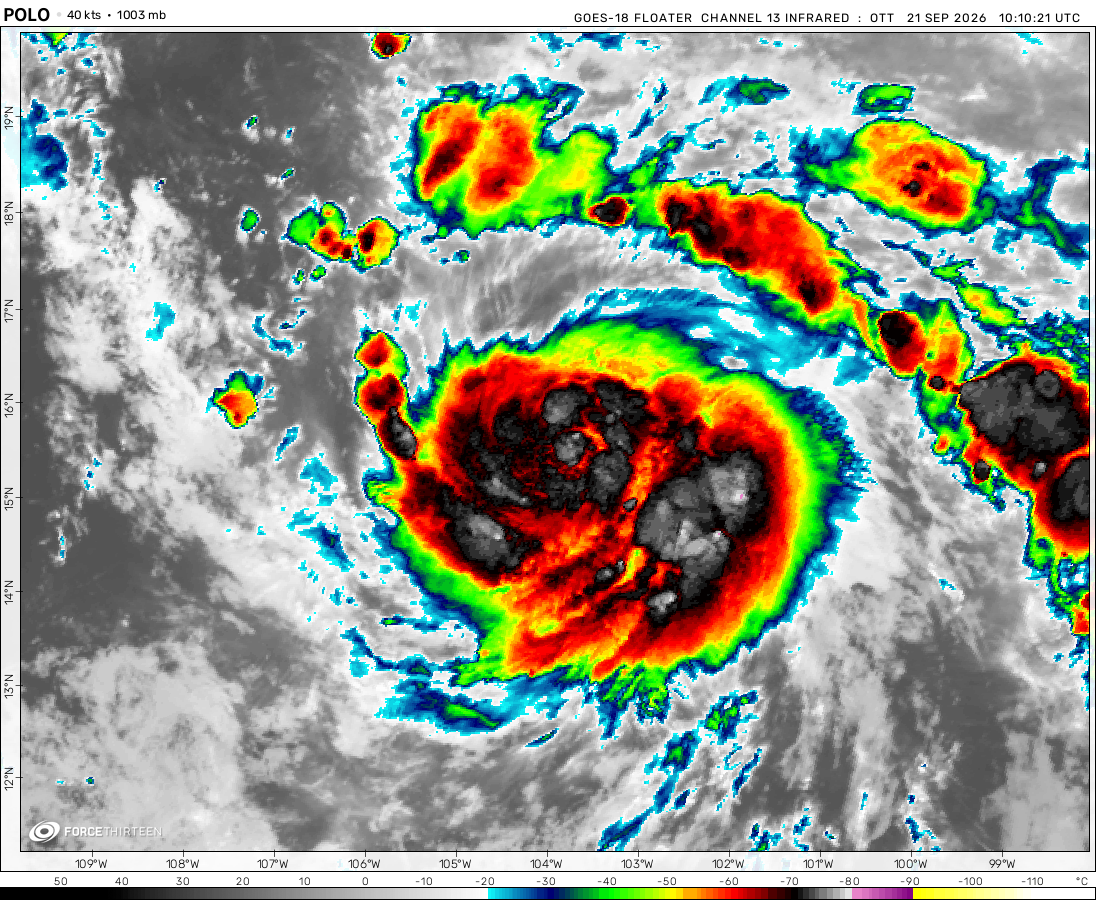
Tropical Storm Rachel was located near 15.7°N, 105.4°W, or about 246 miles (396 km) south-southwest of Manzanillo, Mexico. Rachel has maximum sustained winds of 60 knots and a minimum central pressure of 989 millibars.
Tropical Depression Nineteen-e was located near 14.3°N, 131.2°W, or about 1127 miles (1814 km) west-southwest of Clarion Island, Mexico. Nineteen-e has maximum sustained winds of 30 knots and a minimum central pressure of 1005 millibars.
ATCF®
- Latest Information -
As of September 29th 2026 at 23:32 UTC
Tropical Storm Surigae was located near 29.7°N, 136.7°E, or about 371 miles (597 km) south of Kyoto, Japan. Surigae has maximum sustained winds of 40 knots and a minimum central pressure of 997 millibars.
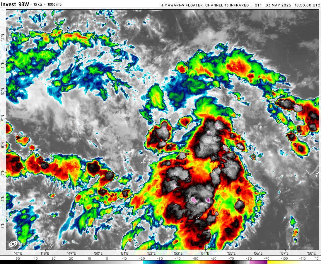
Invest 93W was located near 15.8°N, 152.4°E, or about 536 miles (862 km) east-northeast of Hagåtña, Guam. 93W has maximum sustained winds of 20 knots and a minimum central pressure of 1005 millibars.
tropical storm Cristobal broke the earliest 3 named storms on June 2 and Edouard broke the record for the earliest 5 named storms on July 5 at this rate we might see a season more active then 2005 and have the strongest atlantic storm ever
NEW! Tropical Storm Edourad formed in the open Atlantic, and poses no threat to land. No significant development is expected from the storm. It is headed N NE and soon has a chance of making landfall in Newfoundland.
Stormy Sam
6 years ago
EDOUARD JUST BROKE A RECORD. 2020 IS INSANE!!!
Stormy Sam
6 years ago
Edouard moving very fast at 35 mph, may be moving faster than its wind speed, remnants may reach UK
98L Not very likely to form right now, but once the low crosses the Carolinas it will have a good chance of becoming Fay
96E will not form
97E has a high chance of becoming Cristina midweek
Alex
6 years ago
TD 5 has winds of 40 mph now. Why is it not classified as edouard?
Cookies help us ensure our site works securely, continually make improvements, and personalize your browsing experience.
Click 'Accept All Cookies' to get the best browsing experience. You can change these settings at any time by clicking 'Manage My Cookies' below.
Functional
Always active
The technical storage or access is strictly necessary for the legitimate purpose of enabling the use of a specific service explicitly requested by the subscriber or user, or for the sole purpose of carrying out the transmission of a communication over an electronic communications network.
Preferences
The technical storage or access is necessary for the legitimate purpose of storing preferences that are not requested by the subscriber or user.
Statistics
The technical storage or access that is used exclusively for statistical purposes.The technical storage or access that is used exclusively for anonymous statistical purposes. Without a subpoena, voluntary compliance on the part of your Internet Service Provider, or additional records from a third party, information stored or retrieved for this purpose alone cannot usually be used to identify you.
Marketing
The technical storage or access is required to create user profiles to send advertising, or to track the user on a website or across several websites for similar marketing purposes.

 View more imageryAnimated GIF
 View more imageryAnimated GIF
 View more imageryAnimated GIF
 View more imageryAnimated GIF
 View more imageryAnimated GIF
 View more imageryAnimated GIF
 View more imageryAnimated GIF
tropical storm Cristobal broke the earliest 3 named storms on June 2 and Edouard broke the record for the earliest 5 named storms on July 5 at this rate we might see a season more active then 2005 and have the strongest atlantic storm ever
ts edouard
NEW! Tropical Storm Edourad formed in the open Atlantic, and poses no threat to land. No significant development is expected from the storm. It is headed N NE and soon has a chance of making landfall in Newfoundland.
EDOUARD JUST BROKE A RECORD. 2020 IS INSANE!!!
Edouard moving very fast at 35 mph, may be moving faster than its wind speed, remnants may reach UK
98L Not very likely to form right now, but once the low crosses the Carolinas it will have a good chance of becoming Fay
96E will not form
97E has a high chance of becoming Cristina midweek
TD 5 has winds of 40 mph now. Why is it not classified as edouard?
Fay may form sometime next weekend!
WTF EDOUARD TO FORM TODAY!!!!
tropical depression 5l has formed
97l
There is a disturbance off the Florida coast that strengthened over night and now has gained Rotation and a tropical look.
haven’t been here in a while pretty sure some of u missed me lmao, hmm no storms…
edouard might form
Edouard might form around july 4th
Probably not, since NHC still hasn’t issued any invest areas.
ex04e
New! Tropical Depression Four-E formed in the Pacific, and is not expected to strengthen to a Tropical Storm.
Easterly winds must die
tropical depperson 4e form
There is another system in the coast of South and North Carolina
96L will not form.
95E can possibly become 04E today or tonight, but after that its chances of formation drop heavily.