Tropical Storm Fay was located near 26.3°N, 45.5°W, or about 1230 miles (1980 km) southwest of Santa Cruz das Flores, Azores. Fay has maximum sustained winds of 35 knots and a minimum central pressure of 1008 millibars.
Tropical Storm Hanna was located near 36.1°N, 48.3°W, or about 824 miles (1325 km) south-southeast of St. John's, Newfoundland. Hanna has maximum sustained winds of 40 knots and a minimum central pressure of 1002 millibars.
ATCF®
- Latest Information -
As of September 29th 2026 at 03:46 UTC
Hurricane Nolo was located near 18.3°N, 163.5°W, or about 422 miles (678 km) west-southwest of Honolulu, Hawaii. Nolo has maximum sustained winds of 125 knots and a minimum central pressure of 936 millibars.
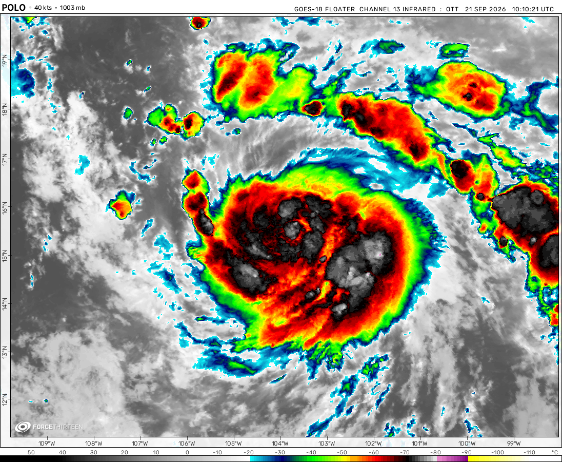
Hurricane Polo was located near 25.5°N, 112.8°W, or about 256 miles (412 km) northwest of Cabo San Lucas, Mexico. Polo has maximum sustained winds of 100 knots and a minimum central pressure of 963 millibars.
Tropical Storm Rachel was located near 14.3°N, 102.5°W, or about 239 miles (385 km) south-southwest of Zihuatanejo, Mexico. Rachel has maximum sustained winds of 50 knots and a minimum central pressure of 997 millibars.
Tropical Storm Surigae was located near 28.6°N, 133.9°E, or about 250 miles (403 km) northeast of Minami-Daitō Island, Japan. Surigae has maximum sustained winds of 55 knots and a minimum central pressure of 988 millibars.
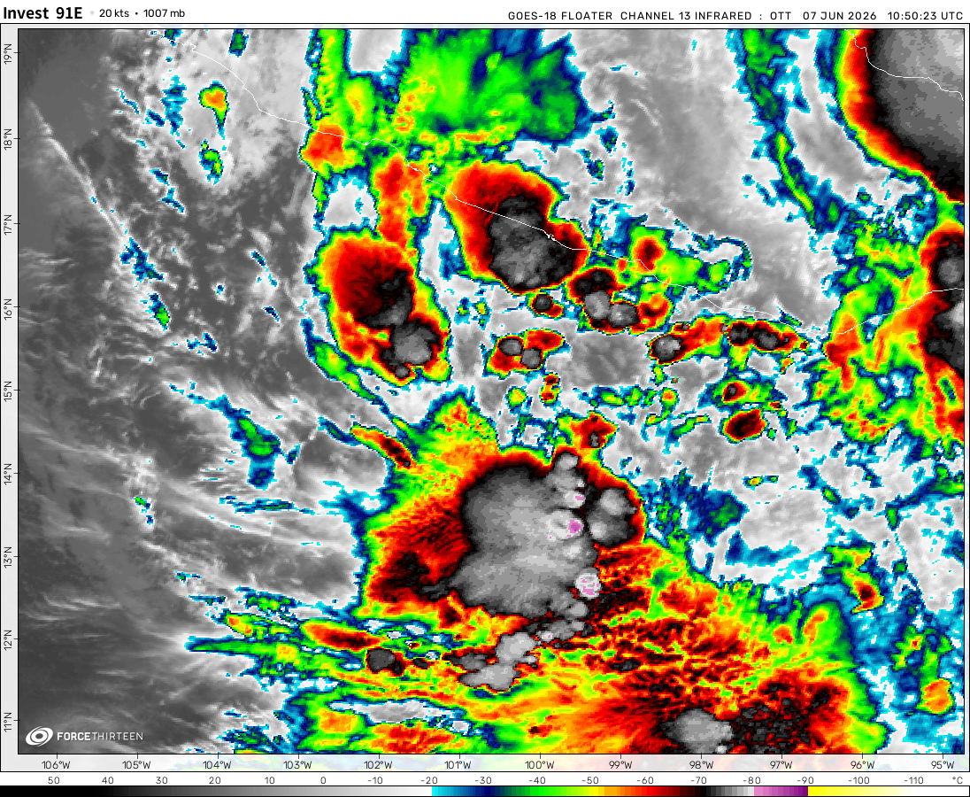
Invest 91E was located near 14.4°N, 133.9°W, or about 1299 miles (2091 km) west of Clarion Island, Mexico. 91E has maximum sustained winds of 30 knots and a minimum central pressure of 1005 millibars.
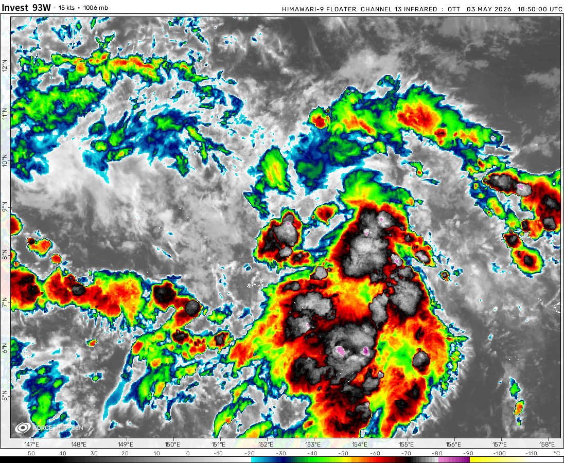
Invest 93W was located near 15.5°N, 155.0°E, or about 700 miles (1126 km) east-northeast of Hagåtña, Guam. 93W has maximum sustained winds of 20 knots and a minimum central pressure of 1008 millibars.
Invest 92W was located near 18.8°N, 97.4°E, or about 394 miles (634 km) east-southeast of Cox's Bazar, Bangladesh. 92W has maximum sustained winds of 20 knots and a minimum central pressure of 1006 millibars.
“Force_23 official website”
Is this copyright?
here’s my logo:
What do you guys think?
My forecasts are much more inaccurate!
Force-23/Fan
2 years ago
Is anyone else here?!! No? Just me? That’s alright I’m making my website which is less popular.
Force-23/Fan
2 years ago
Disturbance 1 will become a tropical storm by next week.
Lately, it has been strengthening further with a higher 40% chance of development over the next 2 days, and 60% over the next 7 days.
Force-23/Fan
2 years ago
Atlantic Hurricane Season Report 2
Invest 99L on the East Coast has wind speeds of 60 miles an hour. Over the next couple of hours, it should weaken.
Invest 90L has lower chances of forming yet it is in the gulf of Mexico and is slowly strengthening but could soon dissipate.
Tropical disturbance 3 has a 40% chance of strengthening within the next 7 days, and it can become a tropical storm, even a hurricane.
Force-23/Fan
2 years ago
I wonder what winter could look like this season. I wonder how the hurricane season will end. What do you guys think?
Weekly Atlantic weather report
My name is “F0rce_23” and for this week’s “weekly Atlantic weather report”, I will report on 2-3 of the Atlantic potential weather systems!
It seems that disturbance one has moved towards the east coast with a low chance of coming development.
Disturbance 2 in the Atlantic has if not dissipated, moved over land precipitation for Texas.
Disturbance 3 has formed and it as well has a low chance of development.
Disturbance 4 has just shifted off of Africa, and it has a low chance of development over the next couple of days, It could develop into a tropical storm As well as disturbance 3 it could still become a hurricane if it shifts towards warm waters.
Force-23/Fan
2 years ago
No oneis trash that is what life is about just be nice and if you wanna say something mean, DONT SAY ITTT!!!
UTTPForce23-Fan
2 years ago
UTTP MY CONTENT IS BETTER+YOUR CONTENT IS TRASH+I HAVE MORE AURA
Also, how do you just jump into this website and target me to bully?! And the rest of the gosh dang website?!! No one cares about what you say, maybe me, but still. If you just target me first, then you must hate me, and might know me quite well, WHO ARE YOU????!!!!
Cookies help us ensure our site works securely, continually make improvements, and personalize your browsing experience.
Click 'Accept All Cookies' to get the best browsing experience. You can change these settings at any time by clicking 'Manage My Cookies' below.
Functional
Always active
The technical storage or access is strictly necessary for the legitimate purpose of enabling the use of a specific service explicitly requested by the subscriber or user, or for the sole purpose of carrying out the transmission of a communication over an electronic communications network.
Preferences
The technical storage or access is necessary for the legitimate purpose of storing preferences that are not requested by the subscriber or user.
Statistics
The technical storage or access that is used exclusively for statistical purposes.The technical storage or access that is used exclusively for anonymous statistical purposes. Without a subpoena, voluntary compliance on the part of your Internet Service Provider, or additional records from a third party, information stored or retrieved for this purpose alone cannot usually be used to identify you.
Marketing
The technical storage or access is required to create user profiles to send advertising, or to track the user on a website or across several websites for similar marketing purposes.

 View more imageryAnimated GIF
 View more imageryAnimated GIF
 View more imageryAnimated GIF
 View more imageryAnimated GIF
 View more imageryAnimated GIF
 View more imageryAnimated GIF
 View more imageryAnimated GIF
 View more imageryAnimated GIF
With the current conditions, invest 91L will become a tropical storm, if not there should be wind shear.
PTC 06L
what
“Force_23 official website”
Is this copyright?
here’s my logo:
What do you guys think?
My forecasts are much more inaccurate!
Is anyone else here?!! No? Just me? That’s alright I’m making my website which is less popular.
Disturbance 1 will become a tropical storm by next week.
Lately, it has been strengthening further with a higher 40% chance of development over the next 2 days, and 60% over the next 7 days.
Atlantic Hurricane Season Report 2
Invest 99L on the East Coast has wind speeds of 60 miles an hour. Over the next couple of hours, it should weaken.
Invest 90L has lower chances of forming yet it is in the gulf of Mexico and is slowly strengthening but could soon dissipate.
Tropical disturbance 3 has a 40% chance of strengthening within the next 7 days, and it can become a tropical storm, even a hurricane.
I wonder what winter could look like this season. I wonder how the hurricane season will end. What do you guys think?
99L looks like a SS
It has wind speeds of a tropical storm but it is an invest.
Invest 99L could become a tropical storm by the next week!
Yagi Has a 12 mile wide eye
26 miles last night
I just measured it and it is actually 15-20 miles wide.
Su typhoon
I hated what was happening yesterday.
That was mentally painful.
True
Ya I feel bad, even tho I wasn’t online.
Tropical system 1 is back again in the gulf of Mexico…
man this is so goofy, random kids trying to assault force-23/fan for no reason, people are trying to be nice in this small community
I got over it. The guy who was on his website was one of my friends.
I annoyed them a bit too much and got mad. Thus nearly destroying this website.
I would say their name, but I can’t due to privacy reasons.
Your welcome again.
When I saw what was happening yesterday, I told F13 what was happening just so they would know.
Wait, what?!!!
You told me to do it. I wasnt sneaky about it.
Bro, who was it?
Weekly Atlantic weather report
My name is “F0rce_23” and for this week’s “weekly Atlantic weather report”, I will report on 2-3 of the Atlantic potential weather systems!
It seems that disturbance one has moved towards the east coast with a low chance of coming development.
Disturbance 2 in the Atlantic has if not dissipated, moved over land precipitation for Texas.
Disturbance 3 has formed and it as well has a low chance of development.
Disturbance 4 has just shifted off of Africa, and it has a low chance of development over the next couple of days, It could develop into a tropical storm As well as disturbance 3 it could still become a hurricane if it shifts towards warm waters.
No oneis trash that is what life is about just be nice and if you wanna say something mean, DONT SAY ITTT!!!
UTTP MY CONTENT IS BETTER+YOUR CONTENT IS TRASH+I HAVE MORE AURA
+no one asked +I have A rizz +I don’t care
Have a cookie!
Also, how do you just jump into this website and target me to bully?! And the rest of the gosh dang website?!! No one cares about what you say, maybe me, but still. If you just target me first, then you must hate me, and might know me quite well, WHO ARE YOU????!!!!
Why are you bullying Force23/FAN? I will report this if this keeps up.
Do it, I am a victim, but he/she might know me since he/she picked on me first.
Done
I got yo back
Thank you as heck
Who was it then? Oh, I know! a UTTP bot
And I might know who it is…
This is suspicious
그만 괴롭히세요. 그렇지 않으면 발로 쫓겨날 것입니다.
UTTP I HATE YAGI
I mean we should dislike storms as well as research them but they have many benefits to our ecosystem.
UTTP I HATE GILMA
UTTP I HATE HONE
Dont copy my user name use this user instead: Force_fan